
Go GIS is a product developed by our team, a geographic information system (GIS) solution for effective geospatial data management.
Go GIS is used by many municipalities in Latvia to monitor the accounting and monitoring of engineering communications, road and street infrastructure, real estate, and construction projects more effectively.
It is suitable for use by specialists of municipalities and municipal capital companies of various levels and responsibilities, for example:
— staff of the building authority
— site planners
— Engineering communications operators
— maintainers and managers of communal institutions
— employees of local government property departments
Data availability
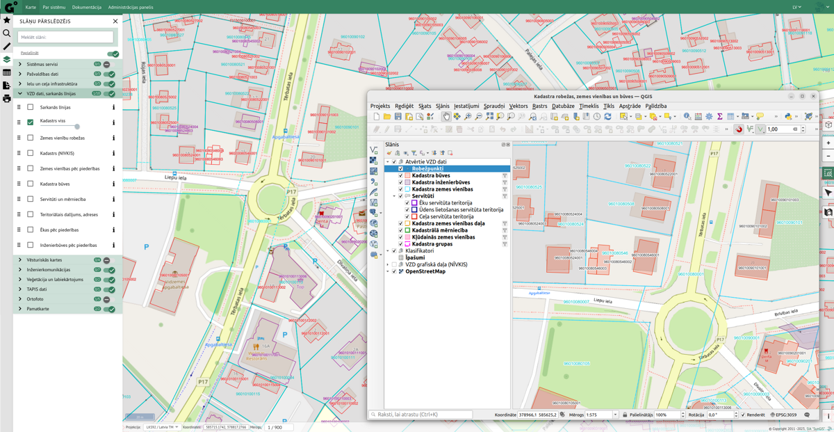
Our developed geographic information system solution, Go GIS, provides quick access to geospatial data from a web browser and a specially developed QGIS project.
Data search
Search for objects by text. Selection by spatial queries:
— the specified point
— marked lines
— polygon
Data export
Selected data can be exported in CSV or XLSX format. Also, in full table export.
Additional XLSX tables have been developed for individual modules - specific reports and reports that include data registered in several tables.
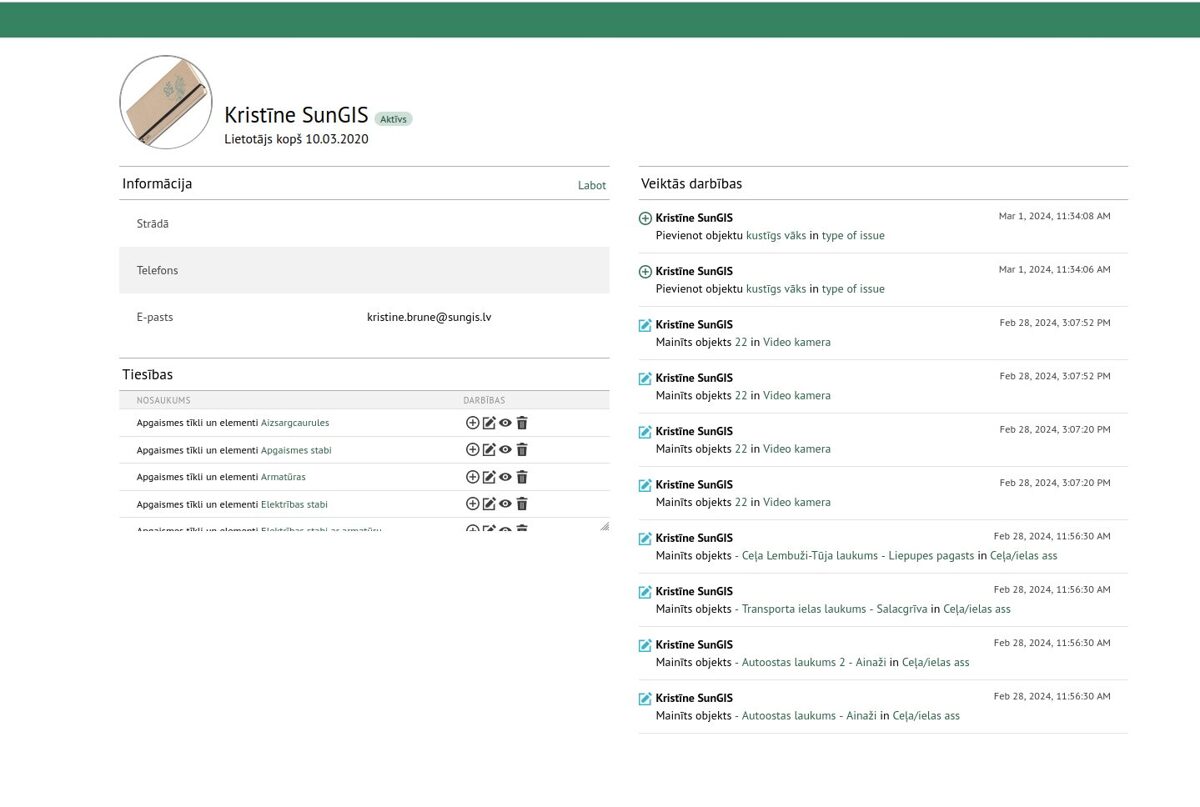
User administration
Register an unlimited number of users, giving each one a different level of rights depending on his role, competence, and responsibilities.
Possibility at any time to change the granted rights or add or deactivate users.
Unlimited layers
In the layers panel, you can easily find the required layer, change the order of layers, and turn them on or off.
It is possible to change their transparency settings.
It is possible to view the data in table format, make their selection, and see more detailed information.
Exports
Exports of overview schemes and maps in A4 and A3 size PDF formats.
It is possible to specify the name of the map and add comments.
The connected layers and the measurements made with the measurement tools appear in the export.
Go GIS modules
When you purchase Go GIS, you will receive the core system modules. However, based on the specific requirements of your operation, it is possible to add any additional modules or develop a new module specifically tailored for you.
Basic system modules
Basic system modules
Module for publishing high-detail topographic information (1:500). With automated recording of ADTI data changes and loading into the database. Ensuring data checking and loading process up to several times a day.
TAPIS
Territorial development planning information system data publication module. The data is updated twice a month.
The State Land Service of Latvia
Open spatial and text data publishing module of the cadastral information system of the State Land Service. The data is updated once a week.
Addresses
Open data publication module of the National Address Register. The data is updated once a day.
Latvian Geospatial Information Agency
current orthophoto maps and topographic maps on a scale of 1:10,000 and 1:2000.
Additional modules
— Latvian distribution data
— Rural support service data
— Nature Protection Administration information system OZOLS data
— Latvian National Road data
— Real estate reclamation cadastre of the Ministry of Agriculture
Engineering communication modules
Lighting networks and elements
Lighting poles, cables, overhead lines, protective pipes, etc., inventory and visualization of objects on the map.
Water pipe networks and other elements
Water wells, valves, pipes, water towers, pressure boosting and processing stations, etc., inventory and visualization of objects on the map.
Domestic sewerage and decentralized sewerage system register
Wells, shut-off fittings, pumping stations, mains and pressure pipes, decentralized sewerage systems, sanitation, etc., inventory and visualization of objects on the map.
Rain drainage and drainage network
Inventory and visualization of water bodies, storages, culverts, ditches, drainage, water pipes, pressure pipes, and NAI objects on the map.
Heating networks and elements
Wells, shut-off fittings, damaged sites, forward and reverse sections, etc., inventory and visualization of objects on the map
Communication networks
Inventory and visualization of communication wells, cables, radio relay lines, switching equipment, and video cameras on the map
Road and street infrastructure
Roads, roadways and their network
Road and street network data input and visualization on the map. Preparation of reports is ensured by Cabinet of Ministers regulations No. 1052 "Registration and accounting of municipal roads and streets".
— road and street technical condition survey journal
— road sign register
— traffic lights register
— traffic accidents register
— sidewalks and landscaping
Real estate accounting and monitoring
Construction plans, reconstructions, and repairs
For the successful implementation of development plans and the supervision of the development process of objects under construction.
— for real estate
— for investment objects
— for accounting and monitoring of construction projects
The data module is being developed as part of the "ZİLE" innovation support program of municipalities of Valmiera City, Beverina, Burtnieki, and Kocēni counties.
Other modules
— civil protection
— register of Cemeteries
— register of trees and tree vegetation
— register of advertisements
— register of violations of public order
— register of spatial projects